Monitor Farmland & Mitigate Climate Risk from Space
Empowering farmers, financial institutions, and partners with real-time satellite imagery, localized AI recommendations, voice advisories, and climate-smart financing.
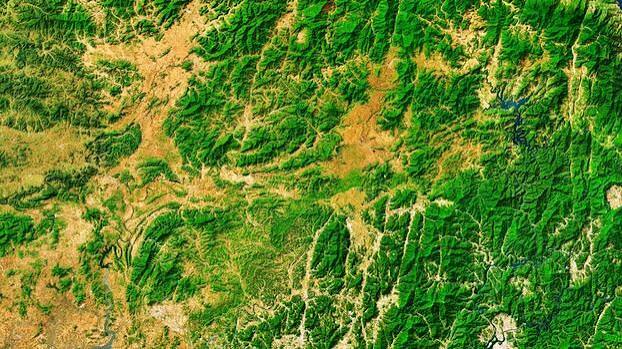
Live Sentinel Radar
NDVI Moisture Score: 0.82 (Optimal)
Trusted & Supported By Global companies and programs
500+
Farmers Supported
230+
Hectares Monitored
4
Local Languages
24/7
Satellite Radar
ClimateTech Capabilities Built for Resilience
End-to-end digital intelligence connecting remote earth observation with smallholder farming reality.
Satellite Monitoring
High-resolution multispectral radar tracking soil moisture, crop health indices (NDVI), and yield forecasts.
Climate Intelligence
Localized weather prediction models and automated climate-risk scoring per farm boundary.
AI Recommendations
Context-aware agronomic insights suggesting optimal planting dates, fertilizer application, and crop packages.
Voice Advisories (4 Languages)
Accessible voice calls in local languages ensuring tech-illiterate smallholders get timely alerts.
Finance Readiness
Verifiable digital farm records and climate risk scores that unlock credit, insurance, and input packages.
Farm Monitoring Dashboard
Centralized intelligence portal for cooperatives, lenders, and agri-businesses to track field operations.
Who We Serve
Tailored climate solutions for every actor across the agricultural value chain.
Smallholder Farmers
Access satellite alerts, voice guidance, and flexible Buy-Now-Pay-Later input financing.
Agricultural Cooperatives
Aggregate farm boundaries, track member crop performance, and secure guaranteed off-take buyers.
Financial Institutions
De-risk ag-lending with satellite-verified risk scores, digital credit profiles, and yield tracking.
NGOs & Development Partners
Measure baseline climate impact, verify sustainable practices, and audit food security initiatives.
How Agricheck Works
Four seamless steps from boundary mapping to harvest financing.
1. Map Farm Boundary
Draw your farm perimeter on a smartphone or web map using GPS and satellite imagery.
2. AI + Satellite Analysis
Our climate models calculate soil health, drought risk, and crop suitability scores.
3. Receive Recommendations
Get personalized agronomic advice and tailored input financing offers based on your risk profile.
4. Voice Calls & Monitoring
Receive weekly localized voice advisories and continuous remote crop monitoring.
Why Choose Agricheck?
See how Agricheck compares to traditional ag-tech and legacy farming methods.
| Capability | Traditional Methods | Agricheck Platform |
|---|---|---|
| Climate Risk Scoring | Manual field visits (Slow & Expensive) | ✓ Real-time AI & Satellite Analysis |
| Smallholder Accessibility | Text-heavy app portals only | ✓ Localized Voice Advisories (4 languages) |
| Input Credit & Financing | High interest collateral requirement | ✓ Risk-based BNPL & Produce repayment |
| Satellite Resolution | Infrequent or static satellite maps | ✓ Continuous radar monitoring & alerts |
Intelligent Farm Management Interface
A streamlined portal providing real-time operational visibility without clutter.
Trusted by Farmers & Cooperatives
"Agricheck transformed how our cooperative operates. The satellite maps helped us prove creditworthiness to banks, and the voice advisories keep our farmers informed."
John K., Cooperative Leader & Maize Farmer
"The localized voice alerts saved my soybean crop from unexpected drought. Knowing exactly when to apply inputs gave me my highest yield ever."
Bright L., Soybean Farmer
See Agricheck in Action
Discover how we leverage space tech, artificial intelligence, and local voice channels to climate-proof agriculture.
Ready to Monitor Your Farm from Space?
Join thousands of farmers, cooperatives, and institutions building climate resilience with Agricheck today.